Expedition teams and organizers
Comprehensive meteorological data for your tour

Those who rely on dubious forecasts or gut feeling in alpine terrain often risk more than just the success of their expedition. That’s why you should rely on the weather services from MetGIS: The advanced combination of satellite data, fine-mesh weather models and high-resolution terrain data enables MetGIS to offer precise weather forecasts for almost anywhere in the world.
Especially over remote regions where weather stations are scarce, our proprietary algorithm delivers astonishingly accurate results. Our universal technical solutions enable us to deliver weather data and forecasts via various channels, including satellite phone, internet and, in developed areas, mobile devices such as smartphones.
 Plan better: from the first stage to the “final pitch”
 Make better decisions in extreme situations
 Avoid unnecessary risk for yourself and your team
 Save valuable energy, time and nerves
![]() English & German-speaking support
English & German-speaking support

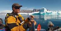
Our service is used successfully all over the world, from canoeists along the Greenland coast, to expeditions in the Patagonian inland ice, to climbs of “classics” and lesser known peaks in the Himalayas, Karakoram and Tienshan mountains. However, it is by no means only aimed at extreme expeditions, but is also ideal for trekking providers, mountain guides and even private individuals who want to play it safe.
Because the weather factor can turn even the best tour planning on its head. Trust MetGIS weather data for expeditions and our expertise to minimize the weather risk to the success of your adventure.
MetGIS forecasts are precise and accurate.
This is how weather forecasts should be!

During my kayak trips in Greenland, the MetGIS weather forecasts were a great help and an important guide!
I could rely on you 100% during my Mongolia expedition!


Our forecast maps are available online and offer you ultra-precise forecasts for the next 2 days (animation). 7-day forecasts in table form are available at the click of a mouse for all locations, summits & camps shown on the map.


We will send you a PDF document to your email address every day. In it you will find the most important weather parameters for the next 4 days graphically displayed (also suitable for smartphones!).
Receive regular, precise, numerical forecasts in compact form directly to your satellite phone. You can individually define the coordinates, the number of daily updates and the dispatch times.


Our meteorologists have years of experience in alpinism and mountain sports as well as the entire spectrum of MetGIS forecast data. This enables us to provide you with individual advice – especially in unstable weather and during critical phases of your expedition.
 Specially developed for mountain weather forecasts
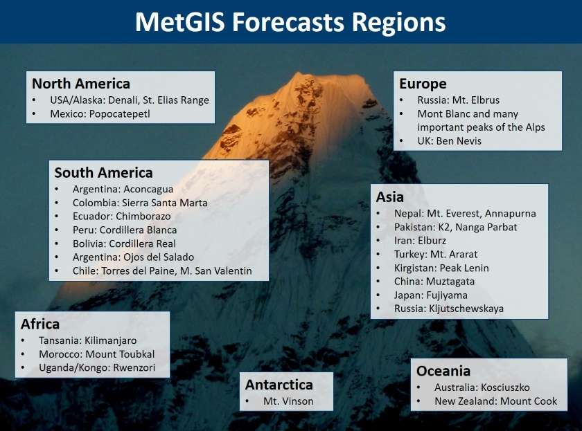
The MetGIS forecasting system is based on extremely accurate terrain data and is therefore particularly suitable for mountainous regions. This is why customers around the world rely on us: from the royal wedding in Bhutan to numerous Himalayan expeditions and mountain sports portals in the Alps.
![]() Meteorologists with experience under extreme conditions
Meteorologists with experience under extreme conditions
Our meteorologists specialize in mountain weather. They have many years of experience, including in mountaineering under extreme conditions. They know the challenges and dangers of alpine terrain and can provide you with particularly valuable, practical assistance.
![]() Ultra-precise forecasts, with up to 30 m resolution
Ultra-precise forecasts, with up to 30 m resolution
Large-scale forecasts often only help you to a limited extent on your expedition. The forecast cannot be precise enough for planning the next stages or for critical decisions. That’s why ultra-precise MetGIS weather forecasts offer a resolution of up to 30 meters.
Do you have questions about our services or any other questions, simply fill out the contact form or send us an e-mail.
We also look forward to your call.

Meteorologe, Entwickler des Designs des MetGIS Prognosesystems
Curriculum vitae
This will close in 0 seconds
This will close in 0 seconds


